2022 Map of Davis
USGS Topo · Published 2022About this map
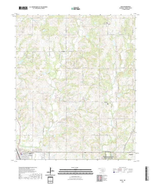
The Arbuckle Mountains region is defined here by the drainage networks of Kickapoo Sandy Cr and Chigley Sandy Cr as they flow toward the Washita River valley. This landscape, centered in Murray County, reveals a transition from the agricultural grid of the northern sections near Iona to the edge of the Chickasaw National Recreation Area in the southeast. The settlement of Davis sits at the southwestern corner, showing a detailed street layout including E Main St and E Davis Ave, while the town of Sulphur anchors the southeastern corner. Significant local landmarks such as the Sandy Baptist Church Cem and the Iona Cem provide vital points of interest for genealogical research. The presence of the Chickasaw Turnpike cutting across the southern sections reflects more recent transportation developments in this long-settled part of Oklahoma.
Find a feature on this map
45 named features on this map. Tap any name to fly to it.
Don’t see what you’re looking for? This feature index may not catch every label — zoom into the map to look around manually.
Map Details
Editions of this 2022 Davis Map
This is the sole edition of this map. No revisions or reprints were ever made.