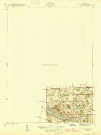
1945 Map of Davisburg
USGS Topo · Published 1945About this map
Davisburg serves as a focal point in the southern portion of this mid-1940s survey, where the Shiawassee river flows through a landscape of kettle lakes and family-named roads. The northern section transitions into Groveland, centered on the intersection at Austin Corners. This map captures a rural Oakland County before significant post-war suburbanization, showing a reliance on localized institutions like the Brondige Sch and the Bigelow Cem along Bigelow Rd. The terrain is characterized by numerous water bodies, including Long Lake, Eliza Lake, and Kirby Lake, which suggest the glacial topography of the region. Local transit is defined by a grid of named thoroughfares such as Rappalee Lake Rd and Wildwood Rd, linking these small agricultural and lakeside communities.
Find a feature on this map
21 named features on this map. Tap any name to fly to it.
Don’t see what you’re looking for? This feature index may not catch every label — zoom into the map to look around manually.
Map Details
Editions of this 1945 Davisburg Map
3 editions found
Other maps of this area

1907 · Pontiac
USGS Topo · 1:62,500

1909 · Milford
USGS Topo · 1:62,500

1920 · Holly
USGS Topo · 1:62,500

1922 · Holly
USGS Topo · 1:62,500

1936 · Highland
USGS Topo · 1:31,680

1936 · Clarkston
USGS Topo · 1:31,680

1942 · Highland
USGS Topo · 1:24,000

1943 · Holly
USGS Topo · 1:62,500

1943 · Clarkston
USGS Topo · 1:24,000

1943 · Ortonville
USGS Topo · 1:24,000