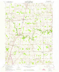
1961 Map of Dawn
USGS Topo · Published 1974About this map
Stillwater River meanders across this rural landscape, carving a valley through the townships of Richland, Wayne, and Greenville. In the early 1960s, the area maintained a dense network of country roads, such as Coppess Road and Bradford Road, connecting small agricultural hubs. The Penn Central railroad cuts a diagonal path through the terrain, passing the grain elevators and residences of Dawn, Stelvideo, and Horatio. This landscape is particularly rich for genealogical study, preserving the locations of numerous family-named landmarks and local institutions, including the Stelvideo Cem and the Childrens Home. While rural in character, the presence of the Darke County Airport near the border of Brown Wayne township indicates the gradual modernization of transportation during the post-war era.
Find a feature on this map
43 named features on this map. Tap any name to fly to it.
Don’t see what you’re looking for? This feature index may not catch every label — zoom into the map to look around manually.
Map Details
Editions of this 1961 Dawn Map
3 editions found
Other maps of this area

1908 · St. Henry
USGS Topo · 1:62,500

1909 · Loramie
USGS Topo · 1:62,500

1911 · Loramie
USGS Topo · 1:62,500

1911 · Covington
USGS Topo · 1:62,500

1944 · Covington
USGS Topo · 1:62,500

1944 · Loramie
USGS Topo · 1:62,500

1953 · Muncie
USGS Topo · 1:250,000

1956 · Muncie
USGS Topo · 1:250,000

1961 · Dawn
USGS Topo · 1:24,000
1961 · Greenville East
USGS Topo · 1:24,000