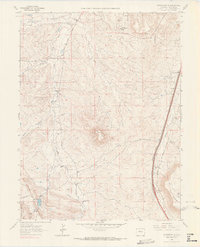
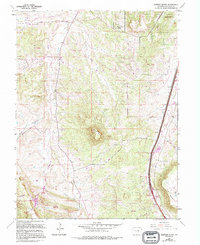
1965 Map of Dawson Butte
USGS Topo · Published 1967About this map
Dawson Butte and Hunt Mountain dominate the skyline of this mid-1960s landscape, where the high plains meet the eastern foothills of the Front Range. The eastern edge of the quadrangle is defined by a busy transportation corridor, featuring the Atchison Topeka and Santa Fe and the Denver and Rio Grande Western railroads running parallel to East Plum Creek. This area shows the early markers of suburban transition with the establishment of Monte Vista Estates and Perry Park Ranch alongside traditional rural foundations.
Find a feature on this map
30 named features on this map. Tap any name to fly to it.
Don’t see what you’re looking for? This feature index may not catch every label — zoom into the map to look around manually.
Map Details
Editions of this 1965 Dawson Butte Map
5 editions found
Other maps of this area

1893 · Platte Canyon
USGS Topo · 1:125,000

1894 · Castle Rock
USGS Topo · 1:125,000

1913 · Castle Rock
USGS Topo · 1:125,000

1940 · Castle Rock
USGS Topo · 1:62,500

1945 · Castle Rock
USGS Topo · 1:62,500

1945 · Kassler
USGS Topo · 1:24,000

1948 · Kassler
USGS Topo · 1:24,000

1953 · Denver
USGS Topo · 1:250,000

1954 · Devils Head
USGS Topo · 1:24,000
1954 · Greenland
USGS Topo · 1:24,000