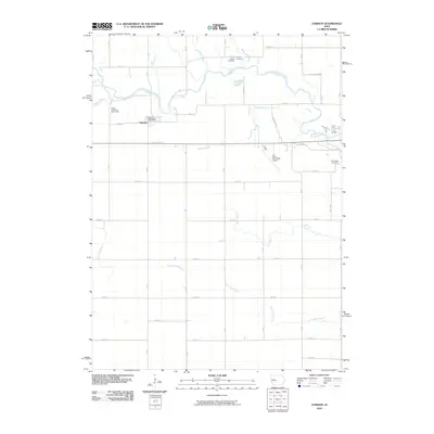
2010 Map of Dawson
USGS Topo · Published 2010About this map
The North Raccoon River winds through this central Iowa landscape, creating a meandering boundary for the settlement of Dawson. This 2010 survey illustrates a primarily agrarian region defined by a precise section-line road grid, including routes like 130th ST and V Ave. The town of Dawson serves as a local focal point, anchored by the Dawson Post Office near the riverbank.
Find a feature on this map
42 named features on this map. Tap any name to fly to it.
Don’t see what you’re looking for? This feature index may not catch every label — zoom into the map to look around manually.
Map Details
Editions of this 2010 Dawson Map
This is the sole edition of this map. No revisions or reprints were ever made.
Other maps of this area

1949 · Adel
USGS Topo · 1:62,500

1950 · Perry
USGS Topo · 1:62,500

1951 · Perry
USGS Topo · 1:62,500

1951 · Adel
USGS Topo · 1:62,500

1952 · Panora
USGS Topo · 1:62,500

1954 · Bagley
USGS Topo · 1:62,500

1954 · Omaha
USGS Topo · 1:250,000

1957 · Omaha
USGS Topo · 1:250,000

1958 · Omaha
USGS Topo · 1:250,000
1982 · Rippey
USGS Topo · 1:24,000