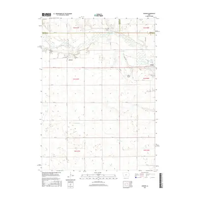
2015 Map of Dawson
USGS Topo · Published 2015About this map
The North Raccoon River winds through this central Iowa landscape, defining the northern border between Dallas, Greene, and Boone counties. The town of Dawson serves as a local focal point, characterized by its grid of streets such as W Railroad Ave and E Railroad St, reflecting a layout influenced by historical rail transport. To the east, the edge of Perry is visible near the river's bend. This agricultural region is punctuated by numerous family and community burial grounds, including the Dallas Township Cemeteries, Bower Cem, and Angus Cem. The terrain is shaped by a network of drainage systems like Bucks Br, Elm Br, and Swan Lake Br, while the Perry Municipal Airport highlights the area's modern infrastructure development amidst the enduring rural sections of Dallas County.
Find a feature on this map
38 named features on this map. Tap any name to fly to it.
Don’t see what you’re looking for? This feature index may not catch every label — zoom into the map to look around manually.
Map Details
Editions of this 2015 Dawson Map
This is the sole edition of this map. No revisions or reprints were ever made.
Other maps of this area

1949 · Adel
USGS Topo · 1:62,500

1950 · Perry
USGS Topo · 1:62,500

1951 · Perry
USGS Topo · 1:62,500

1951 · Adel
USGS Topo · 1:62,500

1952 · Panora
USGS Topo · 1:62,500

1954 · Bagley
USGS Topo · 1:62,500

1954 · Omaha
USGS Topo · 1:250,000

1957 · Omaha
USGS Topo · 1:250,000

1958 · Omaha
USGS Topo · 1:250,000
1982 · Rippey
USGS Topo · 1:24,000