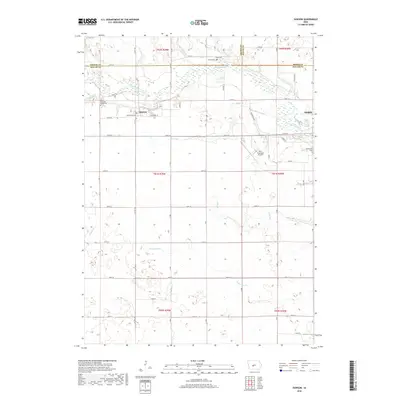
2018 Map of Dawson
USGS Topo · Published 2018About this map
The North Raccoon River winds through the northern half of this Dallas County landscape, defining the topography of the region near Dawson. This small community is situated along the rail corridor marked by W Railroad Ave and E Railroad ST, showing a traditional Midwestern settlement pattern where the town grid aligns with the tracks. The surrounding rural townships are dotted with several burial grounds of interest to genealogists, including the Dallas Township Cemeteries and the Angus Cem located near the northern border.
Find a feature on this map
41 named features on this map. Tap any name to fly to it.
Don’t see what you’re looking for? This feature index may not catch every label — zoom into the map to look around manually.
Map Details
Editions of this 2018 Dawson Map
This is the sole edition of this map. No revisions or reprints were ever made.
Other maps of this area

1949 · Adel
USGS Topo · 1:62,500

1950 · Perry
USGS Topo · 1:62,500

1951 · Perry
USGS Topo · 1:62,500

1951 · Adel
USGS Topo · 1:62,500

1952 · Panora
USGS Topo · 1:62,500

1954 · Bagley
USGS Topo · 1:62,500

1954 · Omaha
USGS Topo · 1:250,000

1957 · Omaha
USGS Topo · 1:250,000

1958 · Omaha
USGS Topo · 1:250,000
1982 · Rippey
USGS Topo · 1:24,000