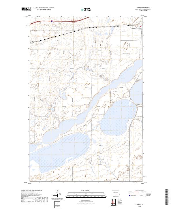
2024 Map of Dawson
USGS Topo · Published 2024About this map
The settlement of Dawson anchors the northeastern corner of this landscape, situated along the corridor of Co Hwy 10. This region is defined by its extensive wetland and prairie pothole ecosystems, dominated by the sprawling boundaries of the Kidder County Waterfowl Production Area. These protected lands surround and preserve vital water bodies including the large, irregular reaches of Alkali Lake and the recreational shores of Lake Isabel and Lake Etta. The map reveals a strictly organized grid of rural roads, such as 42nd St SE and 30th Ave SE, which partition the terrain between the various waterfowl production units. This network illustrates the modern intersection of agricultural land division and significant conservation efforts in the North Dakota plains.
Find a feature on this map
23 named features on this map. Tap any name to fly to it.
Don’t see what you’re looking for? This feature index may not catch every label — zoom into the map to look around manually.
Map Details
Editions of this 2024 Dawson Map
This is the sole edition of this map. No revisions or reprints were ever made.
Other maps of this area

1952 · Tappen South
USGS Topo · 1:24,000

1952 · Dawson
USGS Topo · 1:24,000

1952 · Tappen North
USGS Topo · 1:24,000

1952 · Steele NE
USGS Topo · 1:24,000

1952 · Steele
USGS Topo · 1:24,000

1952 · Steele NW
USGS Topo · 1:24,000

1953 · Jamestown
USGS Topo · 1:250,000

1956 · Jamestown
USGS Topo · 1:250,000
1975 · Tappen North
USGS Topo · 1:24,000

1979 · Kintyre NE
USGS Topo · 1:24,000