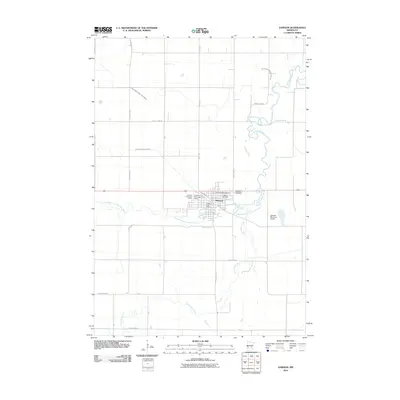
2010 Map of Dawson
USGS Topo · Published 2010About this map
Dawson serves as the focal point of this western Minnesota landscape, where the meandering Lac qui Parle River and its West Branch define the local topography. This 2010 survey illustrates the organized grid of the town site alongside significant agricultural water management systems like Judicial Ditch Number Four and County Ditch Number Ninetyfive. The cultural and civic life of the community is anchored by the Dawson Post Office and the American Legion Golf Course on the town's western edge. Genealogists will find the clustering of three distinct burial grounds particularly notable: Riverside Cemetery, Trinity Lutheran Cemetery, and Dawson Cemetery all lie east of the main settlement, providing a concentrated area for local heritage research.
Find a feature on this map
21 named features on this map. Tap any name to fly to it.
Don’t see what you’re looking for? This feature index may not catch every label — zoom into the map to look around manually.
Map Details
Editions of this 2010 Dawson Map
This is the sole edition of this map. No revisions or reprints were ever made.
Other maps of this area

1953 · Milbank
USGS Topo · 1:250,000

1953 · Watertown
USGS Topo · 1:250,000

1953 · New Ulm
USGS Topo · 1:250,000

1953 · Saint Cloud
USGS Topo · 1:250,000

1957 · Saint Cloud
USGS Topo · 1:250,000

1957 · New Ulm
USGS Topo · 1:250,000

1958 · New Ulm
USGS Topo · 1:250,000

1958 · Milbank
USGS Topo · 1:250,000

1958 · Watertown
USGS Topo · 1:250,000

1958 · Saint Cloud
USGS Topo · 1:250,000