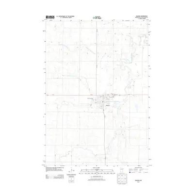
2013 Map of Dawson
USGS Topo · Published 2013About this map
Dawson serves as the primary hub of activity in this section of Lac qui Parle County, situated at the confluence of several local transport routes including Us-212 and Co HWY-23. The landscape is defined by the winding course of the Lac qui Parle River and its West Branch, which are augmented by an extensive network of managed waterways like Judicial Ditch Number Four and County Ditch Number Twentyseven. These ditches represent a significant engineering effort to manage the prairie hydrology for agricultural use. Within the settlement, local history is preserved at the Riverside Cem, Dawson Cem, and Trinity Lutheran Cem, while the American Legion Golf Course and the local Post Office mark the community's social and civic centers. The grid of rural roads, such as 291st Ave, illustrates the persistent township-and-range surveying system that governs the surrounding farmland.
Find a feature on this map
29 named features on this map. Tap any name to fly to it.
Don’t see what you’re looking for? This feature index may not catch every label — zoom into the map to look around manually.
Map Details
Editions of this 2013 Dawson Map
This is the sole edition of this map. No revisions or reprints were ever made.
Other maps of this area

1953 · Milbank
USGS Topo · 1:250,000

1953 · Watertown
USGS Topo · 1:250,000

1953 · New Ulm
USGS Topo · 1:250,000

1953 · Saint Cloud
USGS Topo · 1:250,000

1957 · Saint Cloud
USGS Topo · 1:250,000

1957 · New Ulm
USGS Topo · 1:250,000

1958 · New Ulm
USGS Topo · 1:250,000

1958 · Milbank
USGS Topo · 1:250,000

1958 · Watertown
USGS Topo · 1:250,000

1958 · Saint Cloud
USGS Topo · 1:250,000