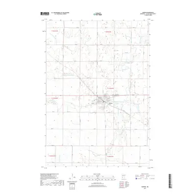
2019 Map of Dawson
USGS Topo · Published 2019About this map
Dawson serves as the central hub of this agricultural landscape in Lac qui Parle County, where the town’s grid is positioned along the West Branch Lac qui Parle River. The 2019 survey documents a highly managed water system, as evidenced by several engineered waterways such as County Ditch Number Twentyseven, Judicial Ditch Number Four, and County Ditch Number Fiftyfive. These features illustrate the region's reliance on precise drainage to support its expansive prairie farmland. Local history is anchored by several sites of remembrance located just north of the town center, including Riverside Cem, Dawson Cem, and the Trinity Lutheran Cem. The presence of the Po and the concentration of street names like Locust, Walnut, and Chestnut near the river indicates the enduring core of this rural Minnesota community.
Find a feature on this map
17 named features on this map. Tap any name to fly to it.
Don’t see what you’re looking for? This feature index may not catch every label — zoom into the map to look around manually.
Map Details
Editions of this 2019 Dawson Map
This is the sole edition of this map. No revisions or reprints were ever made.
Other maps of this area

1953 · Milbank
USGS Topo · 1:250,000

1953 · Watertown
USGS Topo · 1:250,000

1953 · New Ulm
USGS Topo · 1:250,000

1953 · Saint Cloud
USGS Topo · 1:250,000

1957 · Saint Cloud
USGS Topo · 1:250,000

1957 · New Ulm
USGS Topo · 1:250,000

1958 · New Ulm
USGS Topo · 1:250,000

1958 · Milbank
USGS Topo · 1:250,000

1958 · Watertown
USGS Topo · 1:250,000

1958 · Saint Cloud
USGS Topo · 1:250,000