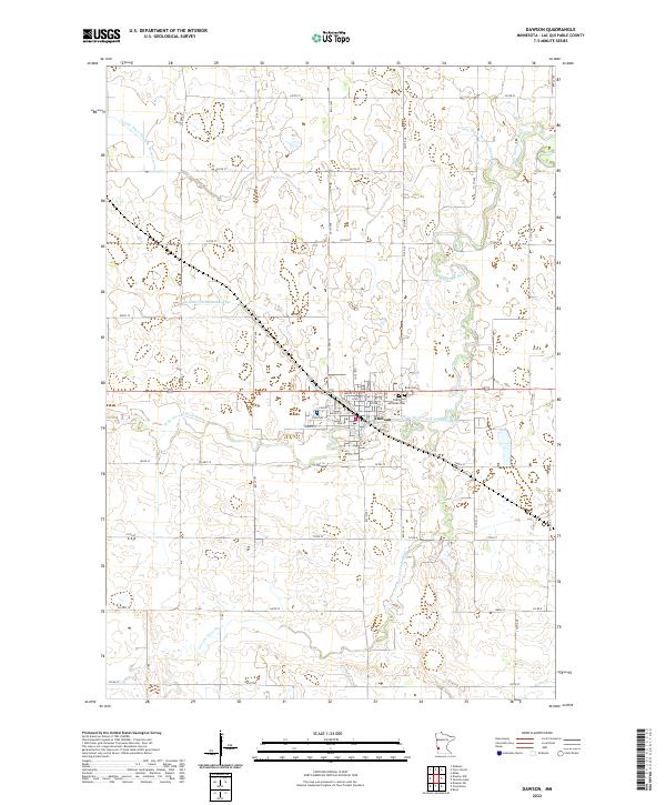
2022 Map of Dawson
USGS Topo · Published 2022About this map
The city of Dawson serves as the central hub of this prairie landscape, where the Lac qui Parle River and its West Branch converge. The urban grid is clearly defined by residential streets like Maple St, Elm St, and Spruce St, centered around the distinctive Diagonal St corridor. On the eastern periphery, the community's history is preserved at Riverside Cem and Trinity Lutheran Cem. Outside the city limits, the landscape is heavily influenced by early 20th-century water management efforts, evidenced by the extensive network of drainage systems including Judicial Ditch Number Four, County Ditch Number Ninety-five, and County Ditch Number Twenty-seven, which transformed the marshy bottomlands into productive agricultural terrain.
Find a feature on this map
59 named features on this map. Tap any name to fly to it.
Don’t see what you’re looking for? This feature index may not catch every label — zoom into the map to look around manually.
Map Details
Editions of this 2022 Dawson Map
This is the sole edition of this map. No revisions or reprints were ever made.
Other maps of this area

1953 · Milbank
USGS Topo · 1:250,000

1953 · Watertown
USGS Topo · 1:250,000

1953 · New Ulm
USGS Topo · 1:250,000

1953 · Saint Cloud
USGS Topo · 1:250,000

1957 · Saint Cloud
USGS Topo · 1:250,000

1957 · New Ulm
USGS Topo · 1:250,000

1958 · New Ulm
USGS Topo · 1:250,000

1958 · Milbank
USGS Topo · 1:250,000

1958 · Watertown
USGS Topo · 1:250,000

1958 · Saint Cloud
USGS Topo · 1:250,000