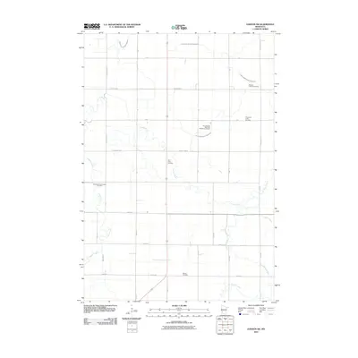
2010 Map of Dawson SW
USGS Topo · Published 2010About this map
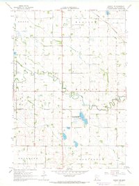
Lazarus Creek and the Lac qui Parle River wind through this prairie landscape in western Lac qui Parle County, defining a rural topography dominated by a precise grid of township roads. The map reveals a deeply rooted settlement pattern marked by numerous denominationally specific burial grounds, such as the Swedish Lutheran Cemetery and the First Swedish Methodist Episcopal Cemetery. These sites, along with Saint Johns Cemetery and the Providence Valley Cemetery, point to the area's immigrant heritage and the central role of rural congregations in the local community. The drainage of this fertile agricultural land is meticulously managed through an extensive network of engineered waterways, including County Ditch Number Eightyfive and County Ditch Number Twentynine A, which supplement the natural courses of Spring Creek and Canby Creek.
Find a feature on this map
37 named features on this map. Tap any name to fly to it.
Don’t see what you’re looking for? This feature index may not catch every label — zoom into the map to look around manually.
Map Details
Editions of this 2010 Dawson SW Map
This is the sole edition of this map. No revisions or reprints were ever made.
Other maps of this area

1953 · Watertown
USGS Topo · 1:250,000

1958 · Watertown
USGS Topo · 1:250,000

1967 · Canby
USGS Topo · 1:24,000

1967 · Dawson SW
USGS Topo · 1:24,000

1967 · Porter
USGS Topo · 1:24,000
1967 · Providence
USGS Topo · 1:24,000
1967 · St Leo
USGS Topo · 1:24,000

1967 · Gary SE
USGS Topo · 1:24,000
1967 · Dawson
USGS Topo · 1:24,000
1967 · Dawson NW
USGS Topo · 1:24,000