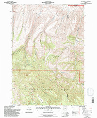
1992 Map of Day Basin
USGS Topo · Published 1997About this map
Nelson Place and the settlement of Antoine sit at the intersection of public lands and private ranching interests in this high-desert landscape. The terrain is defined by the sharp divide of Pine Ridge and the Ochogo National Forest boundary, where numerous gulches like Muir Gulch and Juniper Gulch drain into the wider valleys. Significant water sources such as Home Sweet Home Spring and Breathing Spring punctuate the arid basins, indicating the vital importance of natural springs for livestock and settlement in the region. To the north, the John Day Fossil Beds Nat Mon borders the county line, marking a transition from active timber and grazing lands to protected geological resources. The map also records locally named landmarks like Mcclanahan Meadow and Windy Point, which reflect the area's history of land use and navigation.
Find a feature on this map
33 named features on this map. Tap any name to fly to it.
Don’t see what you’re looking for? This feature index may not catch every label — zoom into the map to look around manually.
Map Details
Editions of this 1992 Day Basin Map
This is the sole edition of this map. No revisions or reprints were ever made.
Other maps of this area

1932 · Dayville
USGS Topo · 1:125,000

1936 · Dayville
USGS Topo · 1:125,000

1953 · Richmond
USGS Topo · 1:62,500

1953 · Picture
USGS Topo · 1:62,500

1955 · Canyon City
USGS Topo · 1:250,000

1959 · Canyon City
USGS Topo · 1:250,000

1966 · Antone
USGS Topo · 1:24,000

1966 · Six Corners
USGS Topo · 1:24,000

1972 · Wolf Mountain
USGS Topo · 1:24,000

1972 · Day Basin
USGS Topo · 1:24,000