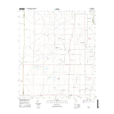
2015 Map of Day
USGS Topo · Published 2015About this map
Day serves as a central hub in this Lafayette County landscape, where agricultural tradition meets the winding course of the Suwannee River at the eastern edge. The settlement pattern is defined by rural communities and small junctions like Townsend, Buckville, and Mayo Junction. Notable for its many limestone sinkhole ponds and lakes, the area features water bodies such as Brewer Lake, Fort Atkinson Lake, and Grassy Pond. The map also captures local history through landmarks like the Fort Atkinson Plantation Airpark and family-named burial sites including Roger Cem and Dees Cem. The western boundary marks the transition into Taylor County, while an extensive network of county roads like CR-53 and CR-250 connects the disparate farmsteads and timberlands that characterize the region.
Find a feature on this map
97 named features on this map. Tap any name to fly to it.
Don’t see what you’re looking for? This feature index may not catch every label — zoom into the map to look around manually.
Map Details
Editions of this 2015 Day Map
This is the sole edition of this map. No revisions or reprints were ever made.
Other maps of this area

1954 · Fenholloway
USGS Topo · 1:24,000

1954 · Day SE
USGS Topo · 1:24,000

1954 · Day
USGS Topo · 1:24,000

1954 · Dowling Park
USGS Topo · 1:24,000

1954 · Day NW
USGS Topo · 1:24,000

1954 · Valdosta
USGS Topo · 1:250,000

1955 · Mayo
USGS Topo · 1:24,000

1958 · Valdosta
USGS Topo · 1:250,000

1958 · Madison SW
USGS Topo · 1:24,000

1958 · Madison SE
USGS Topo · 1:24,000