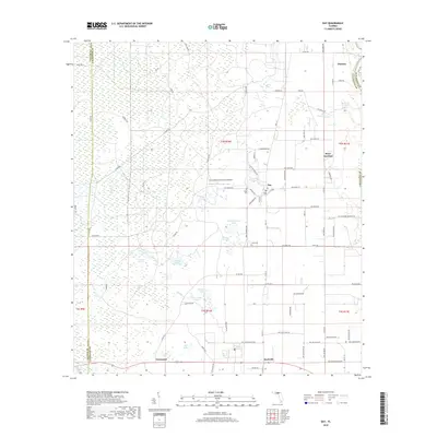
2018 Map of Day
USGS Topo · Published 2018About this map
The Suwannee River forms the northeastern boundary of this Lafayette County landscape, where the flatwoods terrain is punctuated by numerous solution ponds and bays. Scattered settlements like Day and Mayo Junction serve as local anchors for a network of county roads. The map highlights several family-named landmarks and historical sites, including Roger Cem and Dees Cem, providing significant points of interest for genealogists tracing regional lineages.
Find a feature on this map
93 named features on this map. Tap any name to fly to it.
Don’t see what you’re looking for? This feature index may not catch every label — zoom into the map to look around manually.
Map Details
Editions of this 2018 Day Map
This is the sole edition of this map. No revisions or reprints were ever made.
Other maps of this area

1954 · Fenholloway
USGS Topo · 1:24,000

1954 · Day SE
USGS Topo · 1:24,000

1954 · Day
USGS Topo · 1:24,000

1954 · Dowling Park
USGS Topo · 1:24,000

1954 · Day NW
USGS Topo · 1:24,000

1954 · Valdosta
USGS Topo · 1:250,000

1955 · Mayo
USGS Topo · 1:24,000

1958 · Valdosta
USGS Topo · 1:250,000

1958 · Madison SW
USGS Topo · 1:24,000

1958 · Madison SE
USGS Topo · 1:24,000