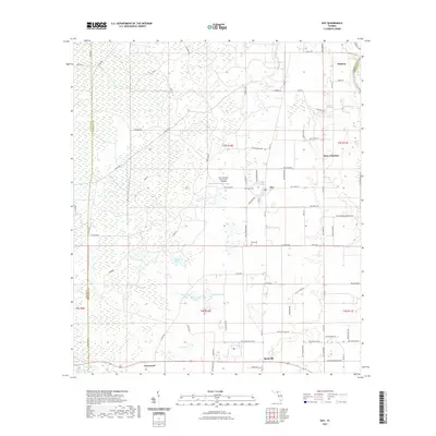
2021 Map of Day
USGS Topo · Published 2021About this map
The low-lying wetlands of San Pedro Bay and Tiger Bay dominate this portion of Lafayette County, where the landscape is defined by a intricate system of cypress ponds and shallow lakes. The central settlement of Day serves as a hub for the surrounding rural area, located near Brewer Lake and the Fort Atkinson Plantation Airpark. Genealogy researchers can find family ties at the Dees Cem and Roger Cem, while the southern reaches of the map show the small communities of Buckville and Townsend. The terrain is marked by numerous water bodies including Stanton Bay, Bell Lake, and Nichols Lake, illustrating the drainage patterns that characterize the Florida panhandle's interior. A network of county roads like Co RD 348 connects these remote settlements across the marshy ground.
Find a feature on this map
92 named features on this map. Tap any name to fly to it.
Don’t see what you’re looking for? This feature index may not catch every label — zoom into the map to look around manually.
Map Details
Editions of this 2021 Day Map
This is the sole edition of this map. No revisions or reprints were ever made.
Other maps of this area

1954 · Fenholloway
USGS Topo · 1:24,000

1954 · Day SE
USGS Topo · 1:24,000

1954 · Day
USGS Topo · 1:24,000

1954 · Dowling Park
USGS Topo · 1:24,000

1954 · Day NW
USGS Topo · 1:24,000

1954 · Valdosta
USGS Topo · 1:250,000

1955 · Mayo
USGS Topo · 1:24,000

1958 · Valdosta
USGS Topo · 1:250,000

1958 · Madison SW
USGS Topo · 1:24,000

1958 · Madison SE
USGS Topo · 1:24,000