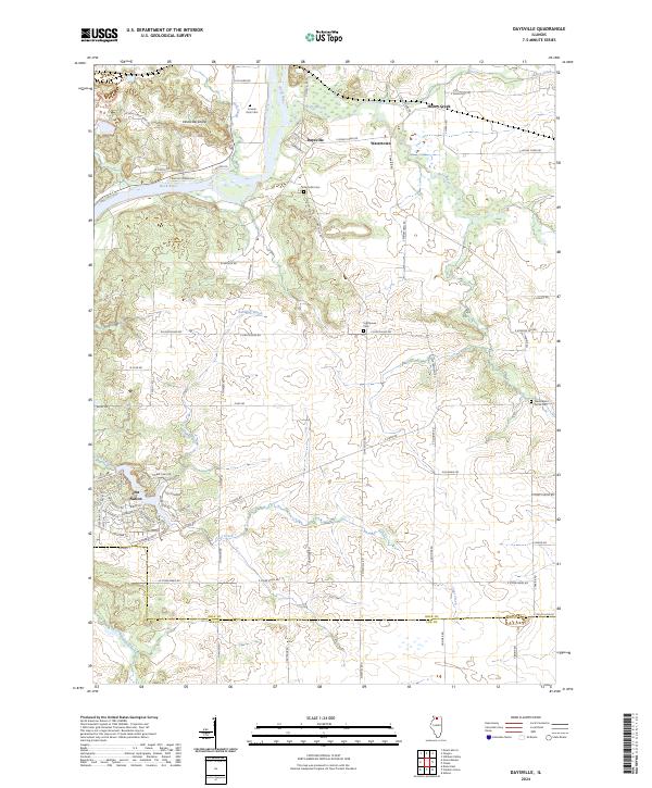
2024 Map of Daysville
USGS Topo · Published 2024About this map
The Rock River and Kyte River converge near the rural settlement of Daysville, defining a landscape where waterway proximity dictated early 19th-century development. This Ogle County terrain is marked by the distinctive Devils Backbone ridge and a network of named water bodies including Honey Creek and Babbling Brook. Significant for genealogists and local historians, the area preserves several burial sites such as Daysville Cem, Lighthouse Cem, and the County Farm Cem. The southern portion of the quadrangle transitions into Lee County, featuring the residential layout of Lost Nation near Clear Creek. The map documents a classic Midwestern agricultural and residential pattern, where modern developments like Watertown sit alongside long-established rural roads like W Devils Back Bone Rd and S Seldom Scene Rd.
Find a feature on this map
77 named features on this map. Tap any name to fly to it.
Don’t see what you’re looking for? This feature index may not catch every label — zoom into the map to look around manually.
Map Details
Editions of this 2024 Daysville Map
This is the sole edition of this map. No revisions or reprints were ever made.
Other maps of this area

1917 · Kings
USGS Topo · 1:62,500

1918 · Dixon
USGS Topo · 1:62,500

1918 · Kings
USGS Topo · 1:62,500

1922 · Oregon
USGS Topo · 1:62,500

1924 · Oregon
USGS Topo · 1:62,500

1950 · Dixon
USGS Topo · 1:62,500

1952 · Rochelle
USGS Topo · 1:62,500

1954 · Rockford
USGS Topo · 1:250,000

1955 · Rockford
USGS Topo · 1:250,000

1958 · Aurora
USGS Topo · 1:250,000
Featured Places
- Oregon, IL
- Franklin Grove Township, IL
- Taylor Township, IL
- LaFayette Township, IL
- Oregon - Nashua Township, IL