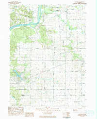
1983 Map of Daysville
USGS Topo · Published 1984About this map
The Rock River carves through the northern landscape of this Ogle County region, defining the topography near the Devils Backbone and the wooded bluffs of Castle Rock State Park. The settlement of Daysville serves as a central point for the local road network, while smaller clusters like Watertown and Carthage anchor the agricultural prairies to the south and east. This 1980s-era documentation reflects a transition in land use, where established recreational sites like Camp Lowden and the Outdoor Ministries Center Camp sit alongside active industrial sites like the Quarry near the Lee County line.
Find a feature on this map
47 named features on this map. Tap any name to fly to it.
Don’t see what you’re looking for? This feature index may not catch every label — zoom into the map to look around manually.
Map Details
Editions of this 1983 Daysville Map
This is the sole edition of this map. No revisions or reprints were ever made.
Other maps of this area

1917 · Kings
USGS Topo · 1:62,500

1918 · Dixon
USGS Topo · 1:62,500

1918 · Kings
USGS Topo · 1:62,500

1922 · Oregon
USGS Topo · 1:62,500

1924 · Oregon
USGS Topo · 1:62,500

1950 · Dixon
USGS Topo · 1:62,500

1952 · Rochelle
USGS Topo · 1:62,500

1954 · Rockford
USGS Topo · 1:250,000

1955 · Rockford
USGS Topo · 1:250,000

1958 · Aurora
USGS Topo · 1:250,000