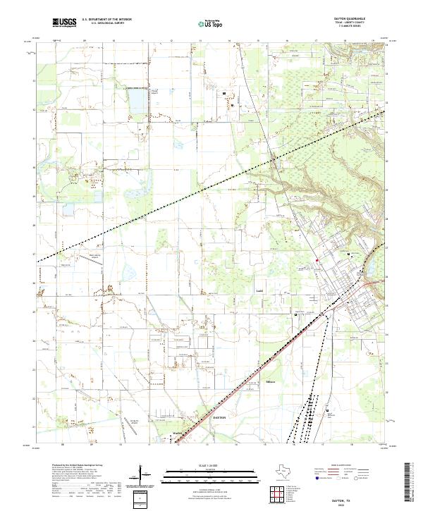
2022 Map of Dayton
USGS Topo · Published 2022About this map
The lowlands of Liberty County unfold around the city of Dayton, where the convergence of several major road corridors meets a complex hydrologic landscape. This modern survey illustrates the proximity of agricultural operations and aviation to the town center, marked by facilities like Pinoak Airport and West Liberty Airport. The terrain is characterized by the branching waterways of the W Prong Old River and E Prong Old River, which snake through the southern and central portions of the quadrangle. Small established communities and naming points such as Stilson, Ladd, and Wadley punctuate the outlying areas, suggesting the enduring footprint of rural Texas settlements.
Find a feature on this map
135 named features on this map. Tap any name to fly to it.
Don’t see what you’re looking for? This feature index may not catch every label — zoom into the map to look around manually.
Map Details
Editions of this 2022 Dayton Map
This is the sole edition of this map. No revisions or reprints were ever made.
Other maps of this area

1916 · Crosby
USGS Topo · 1:24,000

1916 · Huffman
USGS Topo · 1:24,000

1919 · Crosby
USGS Topo · 1:31,680

1920 · Huffman
USGS Topo · 1:31,680

1943 · Liberty
USGS Topo · 1:125,000
1944 · Crosby
USGS Topo · 1:31,680

1950 · Houston
USGS Topo · 1:250,000
1954 · Crosby
USGS Topo · 1:24,000

1954 · Beaumont
USGS Topo · 1:250,000

1955 · Liberty
USGS Topo · 1:62,500