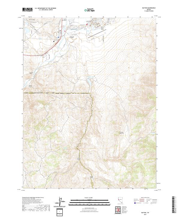
2021 Map of Dayton
USGS Topo · Published 2021About this map
The Carson River winds through this landscape where the high desert meets emerging residential developments and aviation infrastructure. In the northern reaches, the Dayton Valley Airpark and the neighborhood of Carson Plains signify modern growth adjacent to the historic Dayton Cem. The terrain is defined by dramatic shifts in elevation, from the Flowery Ridge and Gold Canyon in the north to the rugged Pine Nut Mountains in the south.
Find a feature on this map
43 named features on this map. Tap any name to fly to it.
Don’t see what you’re looking for? This feature index may not catch every label — zoom into the map to look around manually.
Map Details
Editions of this 2021 Dayton Map
This is the sole edition of this map. No revisions or reprints were ever made.
Other maps of this area

1891 · Carson
USGS Topo · 1:125,000

1891 · Wabuska
USGS Topo · 1:125,000

1893 · Carson
USGS Topo · 1:125,000

1894 · Wabuska
USGS Topo · 1:125,000

1950 · Virginia City
USGS Topo · 1:62,500

1952 · Virginia City
USGS Topo · 1:62,500

1956 · Dayton
USGS Topo · 1:62,500

1957 · Como
USGS Topo · 1:62,500

1957 · Churchill Butte
USGS Topo · 1:62,500

1957 · Reno
USGS Topo · 1:250,000