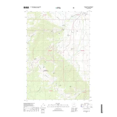
2017 Map of Dayton South
USGS Topo · Published 2017About this map
Dayton marks the northeastern entry point to a landscape where high plains meet the abrupt rising elevations of the Bighorn National Forest. The Tongue River and its tributaries, including the Little Tongue River and S Fork Little Tongue River, carve through the terrain, creating prominent geological features like Tongue River Canyon and Box Canyon.
Find a feature on this map
52 named features on this map. Tap any name to fly to it.
Don’t see what you’re looking for? This feature index may not catch every label — zoom into the map to look around manually.
Map Details
Editions of this 2017 Dayton South Map
This is the sole edition of this map. No revisions or reprints were ever made.
Other maps of this area

1895 · Dayton
USGS Topo · 1:125,000

1901 · Dayton
USGS Topo · 1:125,000

1955 · Sheridan
USGS Topo · 1:250,000

1958 · Sheridan
USGS Topo · 1:250,000

1962 · Sheridan
USGS Topo · 1:250,000

1964 · Wolf
USGS Topo · 1:24,000
1964 · Ranchester
USGS Topo · 1:24,000
1964 · Dayton North
USGS Topo · 1:24,000

1964 · Dayton South
USGS Topo · 1:24,000
1964 · Skull Ridge
USGS Topo · 1:24,000