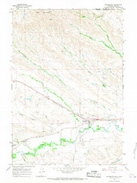
1964 Map of Ranchester
USGS Topo · Published 1967About this map
Ranchester sits at the southern edge of the Wolf Mountains in the mid-1960s, serving as a hub for both rail and irrigation. The town is oriented along the Chicago Burlington and Quincy railroad line, which runs parallel to the Tongue River. This landscape is heavily defined by its water management systems, featuring an extensive network of named irrigation channels such as Wolf Ditch, Tongue River Ditch No 1, and the Hanover route. These ditches divert water from the river to support local land use, while a series of named draws and creeks, including Sixmile Creek and Fivemile Creek, drain the surrounding high ground. Nearby, the location of Mikado and various Gravel Pits indicate the area's industrial and transportation footprints during this period of development in Sheridan County.
Find a feature on this map
35 named features on this map. Tap any name to fly to it.
Don’t see what you’re looking for? This feature index may not catch every label — zoom into the map to look around manually.
Map Details
Editions of this 1964 Ranchester Map
2 editions found
Other maps of this area

1894 · Rosebud
USGS Topo · 1:125,000

1895 · Dayton
USGS Topo · 1:125,000

1901 · Rosebud
USGS Topo · 1:125,000

1901 · Dayton
USGS Topo · 1:125,000

1954 · Hardin
USGS Topo · 1:250,000

1955 · Sheridan
USGS Topo · 1:250,000

1957 · Hardin
USGS Topo · 1:250,000

1958 · Hardin
USGS Topo · 1:250,000

1958 · Sheridan
USGS Topo · 1:250,000

1962 · Sheridan
USGS Topo · 1:250,000