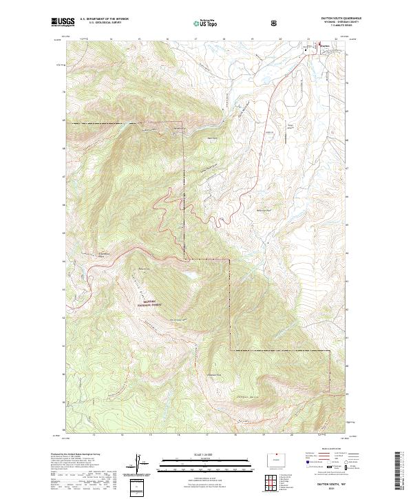
2021 Map of Dayton South
USGS Topo · Published 2021About this map
The town of Dayton and the edges of the Bighorn National Forest anchor this 2021 study of northern Wyoming's dramatic transition from basin to mountains. The map tracks the winding course of the Tongue River as it emerges from Tongue Canyon and flows past agricultural developments like the S Side Ditch and Frisbie Ditch. Notable landmarks outside the town center include the Dayton Cem and the Xingu Airstrip.
Find a feature on this map
49 named features on this map. Tap any name to fly to it.
Don’t see what you’re looking for? This feature index may not catch every label — zoom into the map to look around manually.
Map Details
Editions of this 2021 Dayton South Map
This is the sole edition of this map. No revisions or reprints were ever made.
Other maps of this area

1895 · Dayton
USGS Topo · 1:125,000

1901 · Dayton
USGS Topo · 1:125,000

1955 · Sheridan
USGS Topo · 1:250,000

1958 · Sheridan
USGS Topo · 1:250,000

1962 · Sheridan
USGS Topo · 1:250,000

1964 · Wolf
USGS Topo · 1:24,000
1964 · Ranchester
USGS Topo · 1:24,000
1964 · Dayton North
USGS Topo · 1:24,000

1964 · Dayton South
USGS Topo · 1:24,000
1964 · Skull Ridge
USGS Topo · 1:24,000