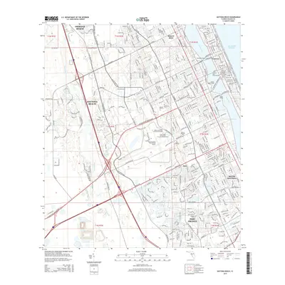
2015 Map of Daytona Beach
USGS Topo · Published 2015About this map
The Halifax River and the Intracoastal Waterway define the coastal geography of this mid-2010s survey, separating the mainland from the bustling beaches. The urban core of Daytona Beach serves as a central hub, flanked by Ormond Beach to the north and Port Orange to the south. Educational and aviation history are deeply embedded in the landscape, evidenced by the sprawling campus of Bethune-Cookman Univ and the extensive facilities at the Daytona International Airport, adjacent to Embry Riddle Aeronautical University-Daytona Beach.
Find a feature on this map
57 named features on this map. Tap any name to fly to it.
Don’t see what you’re looking for? This feature index may not catch every label — zoom into the map to look around manually.
Map Details
Editions of this 2015 Daytona Beach Map
This is the sole edition of this map. No revisions or reprints were ever made.
Other maps of this area

1937 · Port Orange
USGS Topo · 1:48,000

1937 · Ormond
USGS Topo · 1:48,000

1943 · Port Orange
USGS Topo · 1:62,500

1944 · Ormond
USGS Topo · 1:62,500

1944 · Port Orange
USGS Topo · 1:62,500

1952 · Samsula
USGS Topo · 1:24,000

1952 · Daytona Beach
USGS Topo · 1:24,000

1954 · Daytona Beach
USGS Topo · 1:250,000

1956 · Port Orange
USGS Topo · 1:24,000

1956 · Favoretta
USGS Topo · 1:24,000