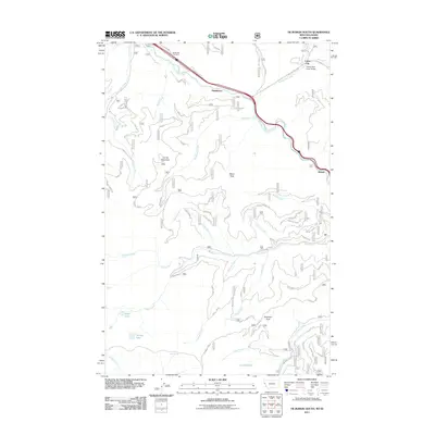
2011 Map of De Borgia South
USGS Topo · Published 2011About this map
Saint Regis River defines the northern corridor of this landscape, where transportation and early settlement align along the water's edge. This high-country region near the Montana-Idaho border shows a distinct pattern of small roadside communities, including Henderson, Drexel, and Cabin City, established where the river valley permits passage between steep mountain ranges. The northern margin is dominated by the historic De Borgia Cemetery and infrastructure like the Twelve Mile Creek Bridge and Frontage Rd W. Moving south, the terrain becomes increasingly complex as the drainage systems of Ward Creek and Fisher Creek carve through the peaks. Genealogists and local historians can trace the relationship between these early travel routes and the remote peaks that define the area, such as Moon Peak and the curiously named Up Up Mountain.
Find a feature on this map
30 named features on this map. Tap any name to fly to it.
Don’t see what you’re looking for? This feature index may not catch every label — zoom into the map to look around manually.
Map Details
Editions of this 2011 De Borgia South Map
This is the sole edition of this map. No revisions or reprints were ever made.
Other maps of this area

1918 · St Regis
USGS Topo · 1:125,000

1919 · St. Regis
USGS Topo · 1:125,000

1956 · St Regis
USGS Topo · 1:62,500

1956 · Wallace
USGS Topo · 1:250,000

1957 · Illinois Peak
USGS Topo · 1:62,500

1957 · Haugan
USGS Topo · 1:62,500

1957 · Simmons Peak
USGS Topo · 1:62,500

1960 · Wallace
USGS Topo · 1:250,000
1988 · Torino Peak
USGS Topo · 1:24,000
1988 · Penrose Peak
USGS Topo · 1:24,000