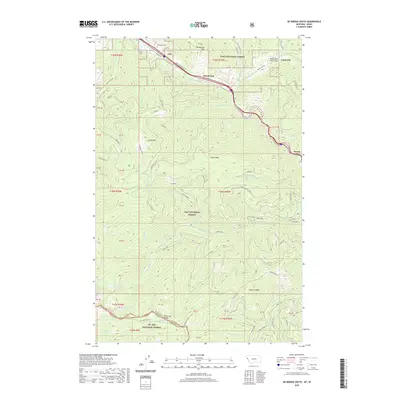
2020 Map of De Borgia South
USGS Topo · Published 2020About this map
Henderson and Cabin City occupy the valley of the Saint Regis River in this high-altitude corner of Mineral County. The map details a landscape defined by the steep slopes of the Bitterroot Range, where elevations rise sharply from the river bottom to prominent heights like Newman Peak and Moon Peak. Transportation through this corridor is marked by the path of the Hiawatha and Frontage Rd, alongside the Twelve Mile Creek Bridge. Beyond the valley floor, the terrain is dominated by the Lolo National Forest, where numerous drainages such as Ward Creek and Canyon Cr carve through the mountains. For those tracing regional history, the presence of the De Borgia Cem near the river provides a specific genealogical touchstone in an otherwise wild landscape characterized by peaks like Up Up Mtn.
Find a feature on this map
65 named features on this map. Tap any name to fly to it.
Don’t see what you’re looking for? This feature index may not catch every label — zoom into the map to look around manually.
Map Details
Editions of this 2020 De Borgia South Map
This is the sole edition of this map. No revisions or reprints were ever made.
Other maps of this area

1918 · St Regis
USGS Topo · 1:125,000

1919 · St. Regis
USGS Topo · 1:125,000

1956 · St Regis
USGS Topo · 1:62,500

1956 · Wallace
USGS Topo · 1:250,000

1957 · Illinois Peak
USGS Topo · 1:62,500

1957 · Haugan
USGS Topo · 1:62,500

1957 · Simmons Peak
USGS Topo · 1:62,500

1960 · Wallace
USGS Topo · 1:250,000
1988 · Torino Peak
USGS Topo · 1:24,000
1988 · Penrose Peak
USGS Topo · 1:24,000