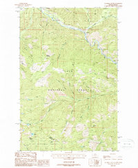
1988 Map of De Borgia South
USGS Topo · Published 1988About this map
The St Regis River corridor defines the Northern Rockies landscape on this late-twentieth-century survey, where the Northern Pacific Railroad parallels the river through the settlements of De Borgia and Henderson. This mountain pass environment is heavily shaped by transportation and forestry, showing an Old RR Grade and several forest service developments. A Cem near the river and the identified Drexel (Site) provide specific points of interest for genealogists and local historians tracing early habitation patterns in the Bitterroot range foothills.
Find a feature on this map
38 named features on this map. Tap any name to fly to it.
Don’t see what you’re looking for? This feature index may not catch every label — zoom into the map to look around manually.
Map Details
Editions of this 1988 De Borgia South Map
This is the sole edition of this map. No revisions or reprints were ever made.
Other maps of this area

1918 · St Regis
USGS Topo · 1:125,000

1919 · St. Regis
USGS Topo · 1:125,000

1956 · St Regis
USGS Topo · 1:62,500

1956 · Wallace
USGS Topo · 1:250,000

1957 · Illinois Peak
USGS Topo · 1:62,500

1957 · Haugan
USGS Topo · 1:62,500

1957 · Simmons Peak
USGS Topo · 1:62,500

1960 · Wallace
USGS Topo · 1:250,000
1988 · Torino Peak
USGS Topo · 1:24,000
1988 · Penrose Peak
USGS Topo · 1:24,000