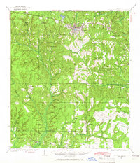
1935 Map of De Funiak Springs
USGS Topo · Published 1965About this map
De Funiak Springs serves as the focal point of this 1930s survey, centered around its distinctive circular lake and the hub of the Louisville and Nashville railroad. The landscape reflects a deeply established rural community in Walton County, marked by a dense network of local schools and churches including Eucheanna Sch, Arcadia Sch, and Macedonia Ch. Transportation is defined by the historic Old Spanish Trail and several significant bridges like Pine Allen Bridge crossing the winding Alaqua Creek.
Find a feature on this map
70 named features on this map. Tap any name to fly to it.
Don’t see what you’re looking for? This feature index may not catch every label — zoom into the map to look around manually.
Map Details
Editions of this 1935 De Funiak Springs Map
2 editions found
Other maps of this area

1934 · Niceville
USGS Topo · 1:48,000

1935 · Villa Tasso
USGS Topo · 1:48,000

1935 · De Funiak Springs
USGS Topo · 1:48,000

1936 · Niceville
USGS Topo · 1:62,500

1936 · Point Washington
USGS Topo · 1:48,000

1938 · Villa Tasso
USGS Topo · 1:62,500

1938 · De Funiak Springs
USGS Topo · 1:62,500

1939 · Point Washington
USGS Topo · 1:62,500

1944 · Bruce
USGS Topo · 1:24,000

1945 · Bruce
USGS Topo · 1:31,680