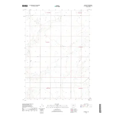
2017 Map of De Grey SE
USGS Topo · Published 2017About this map
Chapelle Cem sits in the rolling prairie of Hughes County, serving as a quiet focal point for this rural landscape east of the Missouri River. The terrain is defined by the winding paths of Chapelle Cr and its southern branch, S Chapelle Cr, which carve shallow drainage patterns through the grasslands of the Big Bend District. This map captures the township and range system at work, with the section lines of t110n r75w and surrounding blocks neatly organized by a network of gravel and local roads. Transport across the area relies on corridors like Co Rd 202 and Westbend Rd, connecting isolated farmsteads. The lack of concentrated settlements highlights the enduring agricultural character of this portion of South Dakota, where the economy remains tied to the land and the seasonal flow of the creeks.
Find a feature on this map
23 named features on this map. Tap any name to fly to it.
Don’t see what you’re looking for? This feature index may not catch every label — zoom into the map to look around manually.
Map Details
Editions of this 2017 De Grey SE Map
This is the sole edition of this map. No revisions or reprints were ever made.
Other maps of this area

1953 · Huron
USGS Topo · 1:250,000

1954 · Huron
USGS Topo · 1:250,000

1966 · Lower Brule NW
USGS Topo · 1:24,000

1966 · Joe Creek
USGS Topo · 1:24,000

1966 · Joe Creek NW
USGS Topo · 1:24,000

1967 · De Grey NE
USGS Topo · 1:24,000
1967 · De Grey NW
USGS Topo · 1:24,000

1973 · De Grey SE
USGS Topo · 1:24,000
1973 · De Grey
USGS Topo · 1:24,000

1973 · Chapelle Lake SW
USGS Topo · 1:24,000