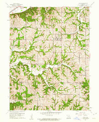
1961 Map of De Kalb
USGS Topo · Published 1977About this map
De Kalb serves as the central hub of this agricultural landscape in Buchanan County, where the terrain is deeply incised by a network of drainage systems. The town is situated on a plateau between the headwaters of Sugar Creek and Lost Creek, demonstrating how early settlement patterns followed the natural ridges to avoid the steep draws and ravines common to the area. Transport and industry are marked by the presence of a Quarry and two major rail lines in the northwest corner, the C B & Q and C R I & P, which skirt the edge of a large body of water simply labeled Lake.
Find a feature on this map
20 named features on this map. Tap any name to fly to it.
Don’t see what you’re looking for? This feature index may not catch every label — zoom into the map to look around manually.
Map Details
Editions of this 1961 De Kalb Map
2 editions found
Other maps of this area

1885 · Atchison
USGS Topo · 1:125,000

1886 · Oskaloosa
USGS Topo · 1:125,000

1888 · Oskaloosa
USGS Topo · 1:125,000

1888 · Atchison
USGS Topo · 1:125,000

1890 · Kansas City
USGS Topo · 1:125,000

1893 · Atchison
USGS Topo · 1:125,000

1894 · Kansas City
USGS Topo · 1:125,000

1894 · Oskaloosa
USGS Topo · 1:125,000

1910 · Leavenworth
USGS Topo · 1:62,500

1926 · Atchison
USGS Topo · 1:62,500