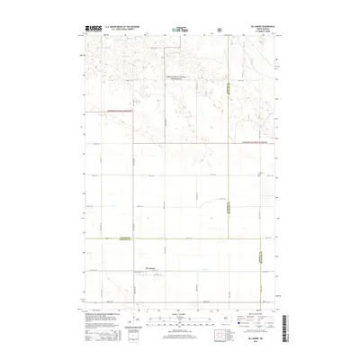
2014 Map of De Lamere
USGS Topo · Published 2014About this map
De Lamere serves as the primary focal point of this rural prairie landscape, positioned near the intersection of Pacific Ave W and 79th St SE. The region is defined by a complex mosaic of natural and administrative boundaries, where the Sheyenne National Grassland dominates the northern half of the territory with its distinctively textured terrain. Water is managed through the winding course of Elk Creek, which meanders across the southern plains. The map meticulously records the convergence of three counties—Ransom, Richland, and Sargent—illustrating how local governance and land management intersect in this corner of North Dakota. Genealogists will find the Anderson Cem east of the grassland, a small but significant site for tracing local family history in this sparsely populated agricultural area.
Find a feature on this map
17 named features on this map. Tap any name to fly to it.
Don’t see what you’re looking for? This feature index may not catch every label — zoom into the map to look around manually.
Map Details
Editions of this 2014 De Lamere Map
This is the sole edition of this map. No revisions or reprints were ever made.
Other maps of this area

1907 · Wyndmere
USGS Topo · 1:125,000

1953 · Fargo
USGS Topo · 1:250,000

1956 · Fargo
USGS Topo · 1:250,000

1958 · Cayuga NW
USGS Topo · 1:24,000

1958 · Hamlin
USGS Topo · 1:24,000

1960 · Wyndmere
USGS Topo · 1:24,000

1960 · Wyndmere NW
USGS Topo · 1:24,000

1960 · De Lamere
USGS Topo · 1:24,000

1960 · Venlo
USGS Topo · 1:24,000

1960 · Milnor
USGS Topo · 1:24,000
Featured Places
- Went End Township, ND
- Wyndmere Township, ND
- Rosemeade Township, ND
- Freeman Township, ND
- Hall Township, ND