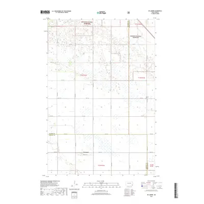
2017 Map of De Lamere
USGS Topo · Published 2017About this map
De Lamere serves as the primary settlement center on this 2017 survey, situated at the intersection of several local routes in the southeastern corner of the plains. The landscape is defined by the expansive Sheyenne National Grassland, which dominates the northern half of the quadrangle with its characteristic sandy soils and pothole wetlands. The transition from public grassland to private agriculture is marked by the distinct section lines and an orderly grid of rural roads including 79th St SE and Co Rd 10. Local history and genealogy are anchored at the Anderson Cem, located just east of the grassland boundary. Hydrology is sparse in this prairie environment, with Elk Cr providing the primary drainage across the central western sections, illustrating the water-scarce nature of the high plains in this region of North Dakota.
Find a feature on this map
24 named features on this map. Tap any name to fly to it.
Don’t see what you’re looking for? This feature index may not catch every label — zoom into the map to look around manually.
Map Details
Editions of this 2017 De Lamere Map
This is the sole edition of this map. No revisions or reprints were ever made.
Other maps of this area

1907 · Wyndmere
USGS Topo · 1:125,000

1953 · Fargo
USGS Topo · 1:250,000

1956 · Fargo
USGS Topo · 1:250,000

1958 · Cayuga NW
USGS Topo · 1:24,000

1958 · Hamlin
USGS Topo · 1:24,000

1960 · Wyndmere
USGS Topo · 1:24,000

1960 · Wyndmere NW
USGS Topo · 1:24,000

1960 · De Lamere
USGS Topo · 1:24,000

1960 · Venlo
USGS Topo · 1:24,000

1960 · Milnor
USGS Topo · 1:24,000
Featured Places
- Went End Township, ND
- Wyndmere Township, ND
- Rosemeade Township, ND
- Freeman Township, ND
- Hall Township, ND