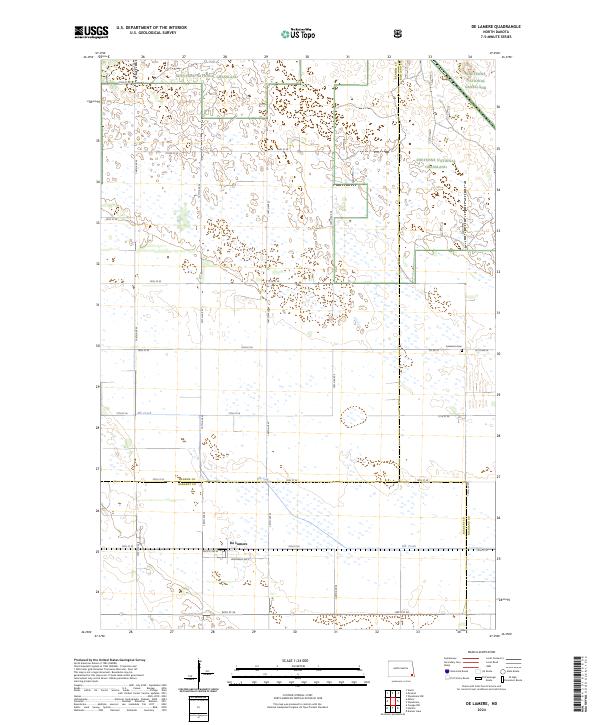
2024 Map of De Lamere
USGS Topo · Published 2024About this map
The settlement of De Lamere sits at the southern edge of this prairie landscape, where the township grid meets the headwaters of Elk Creek. This region is defined by the expansive Sheyenne National Grassland, which dominates the northern and eastern portions of the map. The terrain is characterized by numerous small wetlands and depressions typical of the eastern North Dakota tallgrass prairie, interspersed with a geometric network of section-line roads like 72nd St SE and 147th Ave SE. A notable historical marker for genealogists is the Anderson Cem, located near the junction of Co Rd 10 and 151st Ave SE. The map also captures the meeting point of three counties—Ransom, Sargent, and Richland—illustrating how administrative boundaries were laid over the natural drainage of the Elk Creek basin.
Find a feature on this map
26 named features on this map. Tap any name to fly to it.
Don’t see what you’re looking for? This feature index may not catch every label — zoom into the map to look around manually.
Map Details
Editions of this 2024 De Lamere Map
This is the sole edition of this map. No revisions or reprints were ever made.
Other maps of this area

1907 · Wyndmere
USGS Topo · 1:125,000

1953 · Fargo
USGS Topo · 1:250,000

1956 · Fargo
USGS Topo · 1:250,000

1958 · Cayuga NW
USGS Topo · 1:24,000

1958 · Hamlin
USGS Topo · 1:24,000

1960 · Wyndmere
USGS Topo · 1:24,000

1960 · Wyndmere NW
USGS Topo · 1:24,000

1960 · De Lamere
USGS Topo · 1:24,000

1960 · Venlo
USGS Topo · 1:24,000

1960 · Milnor
USGS Topo · 1:24,000
Featured Places
- Went End Township, ND
- Hall Township, ND
- Wyndmere Township, ND
- Rosemeade Township, ND
- Sandoun Township, ND