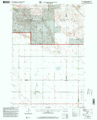
1998 Map of De Lamere
USGS Topo · Published 2000About this map
Sheyenne National Grassland dominates the northern landscape of this North Dakota survey, where the undulating terrain of Sandoun meets a systematic grid of section lines and township boundaries. The map documents the rural settlement patterns near the turn of the millennium, centered on the small community of De Lamere. This agricultural region is characterized by numerous water features, notably several marked as Flowing Well, which indicate the importance of groundwater for the local prairie economy. Social and civic life is anchored by traditional landmarks like the Town Hall and School No 1, while genealogical history is preserved at the Anderson Cem near the Seventh Guide Meridian West. The intersection of multiple county lines, including those of Sargent, Ransom, and Richland, underscores the area's jurisdictional complexity in the eastern part of the state.
Find a feature on this map
16 named features on this map. Tap any name to fly to it.
Don’t see what you’re looking for? This feature index may not catch every label — zoom into the map to look around manually.
Map Details
Editions of this 1998 De Lamere Map
This is the sole edition of this map. No revisions or reprints were ever made.
Other maps of this area

1907 · Wyndmere
USGS Topo · 1:125,000

1953 · Fargo
USGS Topo · 1:250,000

1956 · Fargo
USGS Topo · 1:250,000

1958 · Cayuga NW
USGS Topo · 1:24,000

1958 · Hamlin
USGS Topo · 1:24,000

1960 · Wyndmere
USGS Topo · 1:24,000

1960 · Wyndmere NW
USGS Topo · 1:24,000

1960 · De Lamere
USGS Topo · 1:24,000

1960 · Venlo
USGS Topo · 1:24,000

1960 · Milnor
USGS Topo · 1:24,000
Featured Places
- Hall Township, ND
- Wyndmere Township, ND
- Sandoun Township, ND
- Rosemeade Township, ND
- Freeman Township, ND