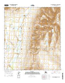
2015 Map of De Long Mountains A-1 NE
USGS Topo · Published 2015About this map
Noatak National Preserve encompasses a significant portion of this high-latitude landscape in the Northwest Arctic Borough. The terrain is defined by the braided path of the Kelly River, which flows south through a broad valley flanked by rising elevations. Along the western edge of the quadrangle, Lik Ridge provides a distinct topographic boundary. This 2015 survey illustrates the untouched character of the western Arctic wilderness, where the land is primarily organized by public land survey systems like t33n r15w and t32n r15w rather than permanent settlements. The lack of infrastructure highlights the area's role as a protected natural corridor, emphasizing the preservation of the watershed and traditional land use patterns in northern Alaska.
Find a feature on this map
8 named features on this map. Tap any name to fly to it.
Don’t see what you’re looking for? This feature index may not catch every label — zoom into the map to look around manually.
Map Details
Editions of this 2015 De Long Mountains A-1 NE Map
This is the sole edition of this map. No revisions or reprints were ever made.
Other maps of this area

1951 · De Long Mountains
USGS Topo · 1:250,000

1951 · Misheguk Mountain
USGS Topo · 1:250,000

1955 · De Long Mountains
USGS Topo · 1:250,000

1955 · Misheguk Mountain A-5
USGS Topo · 1:63,360

1955 · De Long Mountains A-1
USGS Topo · 1:63,360
1955 · De Long Mountains B-1
USGS Topo · 1:63,360

1956 · Misheguk Mountain
USGS Topo · 1:250,000

1965 · De Long Mountains
USGS Topo · 1:250,000
1990 · Misheguk Mountain B-5
USGS Topo · 1:63,360
2015 · De Long Mountains A-1 SW
USGS Topo · 1:25,000