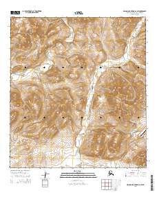
2015 Map of De Long Mountains A-2 SW
USGS Topo · Published 2015About this map
The Punupkahkroak Mtn upland dominates this section of the De Long Mountains, where industrial infrastructure meets the high arctic landscape of Northwest Arctic Borough. The southeastern corner of the map reveals the operational presence of the Red Dog mine complex, anchored by the Red Dog Airport and the critical transportation corridor of the Red Dog Mine Road. This road follows the drainage of Ikalukrok Creek south, providing a window into the logistics of one of the world's most remote mining operations during the early 21st century. The hydrography is defined by the Wulik River and Red Dog Cr, which carve through the high-elevation terrain. This map serves as a record of modern arctic industrial development, capturing the specific footprint of aviation and haulage routes established to support mineral extraction in the Alaskan wilderness.
Find a feature on this map
11 named features on this map. Tap any name to fly to it.
Don’t see what you’re looking for? This feature index may not catch every label — zoom into the map to look around manually.
Map Details
Editions of this 2015 De Long Mountains A-2 SW Map
This is the sole edition of this map. No revisions or reprints were ever made.
Other maps of this area

1951 · De Long Mountains
USGS Topo · 1:250,000

1951 · Noatak
USGS Topo · 1:250,000

1955 · Noatak
USGS Topo · 1:250,000

1955 · De Long Mountains
USGS Topo · 1:250,000

1955 · Noatak D-3
USGS Topo · 1:63,360

1955 · Noatak D-2
USGS Topo · 1:63,360

1955 · De Long Mountains A-3
USGS Topo · 1:63,360

1955 · De Long Mountains A-2
USGS Topo · 1:63,360

1964 · Noatak
USGS Topo · 1:250,000

1965 · De Long Mountains
USGS Topo · 1:250,000