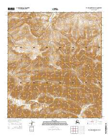
2015 Map of De Long Mountains B-3 SE
USGS Topo · Published 2015About this map
The De Long Mountains dominate this high-latitude terrain, where the crests of Satsiksuk Mtn and Ipkagnaktaugruk Mtn define a landscape shaped by extreme arctic drainage patterns. Water systems here flow toward disparate basins, with the Kukpuk River carving through the western reaches while the Sooner River and the W Fork Wulik River drain the northern and southeastern slopes respectively. This 2015 U.S. Geological Survey representation of the North Slope reflects a wilderness area defined almost entirely by its topographic relief and hydrography, lacking the permanent human settlements or infrastructure common in more temperate regions. The map provides a detailed record of these named peaks and river headwaters within the framework of the Public Land Survey System, specifically marking the convergence of various townships and ranges such as t34n r20w and t12s r49w.
Find a feature on this map
12 named features on this map. Tap any name to fly to it.
Don’t see what you’re looking for? This feature index may not catch every label — zoom into the map to look around manually.
Map Details
Editions of this 2015 De Long Mountains B-3 SE Map
This is the sole edition of this map. No revisions or reprints were ever made.
Other maps of this area

1951 · De Long Mountains
USGS Topo · 1:250,000

1955 · De Long Mountains
USGS Topo · 1:250,000

1955 · De Long Mountains A-3
USGS Topo · 1:63,360

1955 · De Long Mountains A-2
USGS Topo · 1:63,360

1955 · De Long Mountains B-3
USGS Topo · 1:63,360

1955 · De Long Mountains B-2
USGS Topo · 1:63,360

1965 · De Long Mountains
USGS Topo · 1:250,000
2015 · De Long Mountains A-2 NW
USGS Topo · 1:25,000
2015 · De Long Mountains B-2 SW
USGS Topo · 1:25,000
2015 · De Long Mountains B-3 NE
USGS Topo · 1:25,000