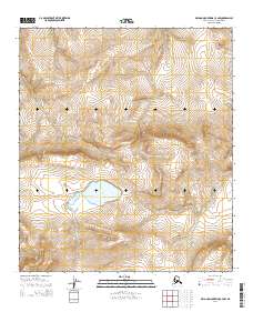
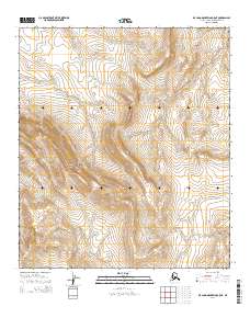
2014 Map of De Long Mountains C-4 NW
USGS Topo · Published 2014About this map
Windy Lake occupies a central basin within this high-latitude terrain of the De Long Mountains, providing a primary hydrological anchor for the surrounding slopes. The landscape is defined by the systematic township and range divisions of the North Slope, including t9s r53w and t8s r52w. This 2014 survey documents the drainage patterns and elevation contours that characterize the wilderness north of the Arctic Circle, where the topography rises sharply from the basin floor. While the region remains largely uninhabited by permanent settlements, the precise mapping of water bodies like Windy Lake serves as a critical reference for navigating this remote corner of Alaska.
Find a feature on this map
6 named features on this map. Tap any name to fly to it.
Don’t see what you’re looking for? This feature index may not catch every label — zoom into the map to look around manually.
Map Details
Editions of this 2014 De Long Mountains C-4 NW Map
This is the sole edition of this map. No revisions or reprints were ever made.
Other maps of this area

1951 · De Long Mountains
USGS Topo · 1:250,000

1955 · De Long Mountains
USGS Topo · 1:250,000

1955 · De Long Mountains D-4
USGS Topo · 1:63,360

1955 · De Long Mountains C-4
USGS Topo · 1:63,360

1955 · De Long Mountains C-5
USGS Topo · 1:63,360
1955 · De Long Mountains D-5
USGS Topo · 1:63,360

1965 · De Long Mountains
USGS Topo · 1:250,000
2014 · De Long Mountains D-4 SW
USGS Topo · 1:25,000
2014 · De Long Mountains C-4 SE
USGS Topo · 1:25,000
2014 · De Long Mountains C-5 NE
USGS Topo · 1:25,000