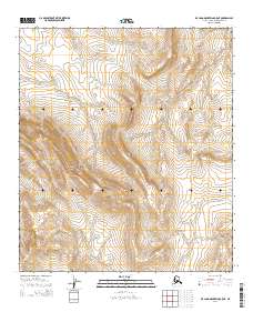
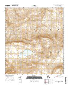
2014 Map of De Long Mountains C-5 NE
USGS Topo · Published 2014About this map
Thetis Ridge dominates this northern Alaskan landscape, providing a primary topographical landmark in an area defined by its significant elevation changes and natural drainage patterns. The 2014 survey documents the complex system of ridgelines and valleys within the De Long Mountains, highlighting the unpopulated and undeveloped character of the North Slope. Surveying lines for townships including t8s r54w, t8s r53w, and t9s r54w overlay the terrain, indicating the formal cadastral organization of these remote public lands. The lack of man-made structures or improved roads underscores the isolation of this region, where the land remains shaped almost entirely by natural forces and geologic time.
Find a feature on this map
6 named features on this map. Tap any name to fly to it.
Don’t see what you’re looking for? This feature index may not catch every label — zoom into the map to look around manually.
Map Details
Editions of this 2014 De Long Mountains C-5 NE Map
This is the sole edition of this map. No revisions or reprints were ever made.
Other maps of this area

1951 · De Long Mountains
USGS Topo · 1:250,000

1955 · De Long Mountains
USGS Topo · 1:250,000

1955 · De Long Mountains D-4
USGS Topo · 1:63,360

1955 · De Long Mountains C-4
USGS Topo · 1:63,360

1955 · De Long Mountains C-5
USGS Topo · 1:63,360
1955 · De Long Mountains D-5
USGS Topo · 1:63,360

1965 · De Long Mountains
USGS Topo · 1:250,000
2014 · De Long Mountains D-4 SW
USGS Topo · 1:25,000
2014 · De Long Mountains C-5 SW
USGS Topo · 1:25,000
2014 · De Long Mountains C-4 NW
USGS Topo · 1:25,000