
1955 Map of De Long Mountains C-5
USGS Topo · Published 1971About this map
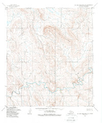
Thetis Ridge and Beckett Ridge dominate this interior Alaskan landscape, defining the high ground between significant Arctic drainage systems. This 1955 survey, mapped by the U.S. Army Topographic Command, captures the wilderness prior to modern resource development, focusing on the winding course of the Ipewik River as it cuts through the southern half of the quadrangle. The topography reveals a complex network of unnamed seasonal drainages feeding into the Nilik River and Thetis Creek, illustrating the natural hydrological patterns of the North Slope. Lacking any roads or established settlements, the map serves as a primary record of the terrain as it was navigated by indigenous hunters and early geological surveyors in the mid-20th century.
Find a feature on this map
6 named features on this map. Tap any name to fly to it.
Don’t see what you’re looking for? This feature index may not catch every label — zoom into the map to look around manually.
Map Details
Editions of this 1955 De Long Mountains C-5 Map
2 editions found
Other maps of this area

1951 · De Long Mountains
USGS Topo · 1:250,000

1952 · Point Hope
USGS Topo · 1:250,000

1952 · Point Hope D-1
USGS Topo · 1:63,360

1955 · De Long Mountains
USGS Topo · 1:250,000

1955 · Point Hope
USGS Topo · 1:250,000

1955 · Point Hope C-1
USGS Topo · 1:63,360

1955 · Point Hope B-1
USGS Topo · 1:63,360

1955 · De Long Mountains D-4
USGS Topo · 1:63,360

1955 · De Long Mountains C-4
USGS Topo · 1:63,360
1955 · De Long Mountains B-5
USGS Topo · 1:63,360