
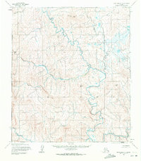
1955 Map of Point Hope C-1
USGS Topo · Published 1966About this map
Nilik River and the Ipewik River dominate this mid-century landscape in the Alaskan Arctic, winding through a complex system of drainage basins and highlands. Established from 1950s aerial photography by the Army Map Service, the topography reveals a roadless wilderness characterized by significant landmarks like Tunak Mountain and South Aluk Hill. The intricate network of waterways, including the meandering Oligavik Creek and Tungnak Creek, illustrates the hydrological patterns of the North Slope before significant modern infrastructure. This 1:63,360 scale study captures the remote character of the region as it was understood during the early Cold War era, providing a primary record of native place names and natural features like Amullik Hill and Sakvelak Creek.
Find a feature on this map
11 named features on this map. Tap any name to fly to it.
Don’t see what you’re looking for? This feature index may not catch every label — zoom into the map to look around manually.
Map Details
Editions of this 1955 Point Hope C-1 Map
2 editions found
Other maps of this area

1951 · De Long Mountains
USGS Topo · 1:250,000

1952 · Point Hope
USGS Topo · 1:250,000

1952 · Point Hope D-1
USGS Topo · 1:63,360

1952 · Point Hope D-2
USGS Topo · 1:63,360

1955 · De Long Mountains
USGS Topo · 1:250,000

1955 · Point Hope
USGS Topo · 1:250,000

1955 · Point Hope B-1
USGS Topo · 1:63,360

1955 · Point Hope C-2
USGS Topo · 1:63,360

1955 · Point Hope B-2
USGS Topo · 1:63,360

1955 · De Long Mountains C-5
USGS Topo · 1:63,360