
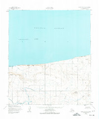
1952 Map of Point Hope D-1
USGS Topo · Published 1959About this map
Corwin Mine sits at the northern edge of this coastal landscape, situated near the dramatic Corwin Bluff overlooking the Arctic Ocean. In the early 1950s, this remote stretch of the North Slope was defined by its drainage systems and high coastal ridges. The terrain rises from the Chukchi Sea through the Sapumik Ridge and into the Kitkonak Hill interior. The hydrological network is well-documented, featuring the waters of Ahyougatuk Lake and several significant drainages including Etsook Creek, Nigiktlik Creek, and Tungnak Creek. The map provides a detailed view of the Ahyougatuk Hills and North Alak Hills, documenting the shoreline and topography before significant modern shifts in Arctic infrastructure.
Find a feature on this map
15 named features on this map. Tap any name to fly to it.
Don’t see what you’re looking for? This feature index may not catch every label — zoom into the map to look around manually.
Map Details
Editions of this 1952 Point Hope D-1 Map
2 editions found
Other maps of this area

1951 · De Long Mountains
USGS Topo · 1:250,000

1951 · Point Lay
USGS Topo · 1:250,000

1952 · Point Hope
USGS Topo · 1:250,000

1952 · Point Hope D-2
USGS Topo · 1:63,360

1955 · De Long Mountains
USGS Topo · 1:250,000

1955 · Point Lay
USGS Topo · 1:250,000

1955 · Point Hope
USGS Topo · 1:250,000

1955 · Point Hope C-1
USGS Topo · 1:63,360

1955 · Point Hope C-2
USGS Topo · 1:63,360

1955 · De Long Mountains C-5
USGS Topo · 1:63,360