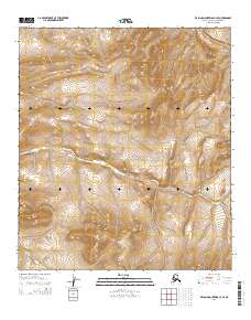
2014 Map of De Long Mountains C-4 SE
USGS Topo · Published 2014About this map
The Ipewik River meanders across this northern landscape, cutting through the high country of the De Long Mountains within the North Slope Borough. This 2014 survey documents a territory defined by intricate elevation changes and the natural drainage patterns of the Arctic. In the southern portion of the quadrangle, the Woolfe Fork begins its course, illustrating the topographical divide that directs the flow of these remote waterways. The map provides a detailed view of the Public Land Survey System grid, including townships like t10s r52w and t10s r51w, which provide the essential spatial framework for researchers and land managers tracking this undisturbed environment.
Find a feature on this map
8 named features on this map. Tap any name to fly to it.
Don’t see what you’re looking for? This feature index may not catch every label — zoom into the map to look around manually.
Map Details
Editions of this 2014 De Long Mountains C-4 SE Map
This is the sole edition of this map. No revisions or reprints were ever made.
Other maps of this area

1951 · De Long Mountains
USGS Topo · 1:250,000

1955 · De Long Mountains
USGS Topo · 1:250,000

1955 · De Long Mountains C-4
USGS Topo · 1:63,360

1955 · De Long Mountains B-3
USGS Topo · 1:63,360
1955 · De Long Mountains B-4
USGS Topo · 1:63,360
1955 · De Long Mountains C-3
USGS Topo · 1:63,360

1965 · De Long Mountains
USGS Topo · 1:250,000
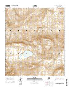
2014 · De Long Mountains C-4 NW
USGS Topo · 1:25,000
2014 · De Long Mountains C-4 SW
USGS Topo · 1:25,000
2014 · De Long Mountains C-4 NE
USGS Topo · 1:25,000