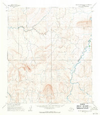
1955 Map of De Long Mountains C-3
USGS Topo · Published 1971About this map
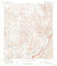
Kukpowruk River and its meandering tributaries dominate this mid-century topographic study of the remote North Slope. Based on aerial photography and field annotation from the mid-1950s, the terrain is defined by a dense network of watercourses and intricate contour lines that reveal the high-latitude drainage patterns of the region. The Pitmegea River cuts through the northwest, while the Sooner River and Ipewik River navigate the southern reaches, highlighting the natural hydrological divisions of the Arctic landscape before modern infrastructure reached this part of the De Long Mountains. The absence of named settlements or roads underscores the primary role of these rivers as the defining landmarks for navigation and land management by the Bureau of Land Management and the U.S. Army Topographic Command during this era.
Find a feature on this map
5 named features on this map. Tap any name to fly to it.
Don’t see what you’re looking for? This feature index may not catch every label — zoom into the map to look around manually.
Map Details
Editions of this 1955 De Long Mountains C-3 Map
2 editions found
Other maps of this area

1951 · De Long Mountains
USGS Topo · 1:250,000

1955 · De Long Mountains
USGS Topo · 1:250,000

1955 · De Long Mountains D-2
USGS Topo · 1:63,360
1955 · De Long Mountains C-2
USGS Topo · 1:63,360
1955 · De Long Mountains D-3
USGS Topo · 1:63,360

1955 · De Long Mountains D-4
USGS Topo · 1:63,360

1955 · De Long Mountains C-4
USGS Topo · 1:63,360

1955 · De Long Mountains B-3
USGS Topo · 1:63,360
1955 · De Long Mountains B-4
USGS Topo · 1:63,360

1955 · De Long Mountains B-2
USGS Topo · 1:63,360