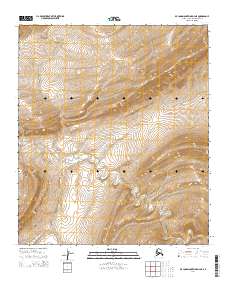
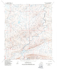
2014 Map of De Long Mountains D-3 NE
USGS Topo · Published 2014About this map
Turbid Cr winds through this high-latitude terrain of the North Slope, serving as the primary drainage for the surrounding hills. This 2014 survey documents the remote landscape where Township 5 South and Township 6 South meet between Ranges 48 and 49 West. The contour intervals reveal a complex system of ridges and valleys that define this arctic environment, providing a technical perspective on the topography before the effects of more recent climate shifts were fully mapped. This specific quadrangle covers a segment of the De Long Mountains, showing the natural path of waterways like Turbid Cr as they negotiate the local elevation changes.
Find a feature on this map
5 named features on this map. Tap any name to fly to it.
Don’t see what you’re looking for? This feature index may not catch every label — zoom into the map to look around manually.
Map Details
Editions of this 2014 De Long Mountains D-3 NE Map
This is the sole edition of this map. No revisions or reprints were ever made.
Other maps of this area

1951 · De Long Mountains
USGS Topo · 1:250,000

1951 · Point Lay
USGS Topo · 1:250,000

1955 · De Long Mountains
USGS Topo · 1:250,000

1955 · Point Lay
USGS Topo · 1:250,000

1955 · De Long Mountains D-2
USGS Topo · 1:63,360
1955 · Point Lay A-3 & 4
USGS Topo · 1:63,360
1955 · Point Lay A-2
USGS Topo · 1:63,360
1955 · De Long Mountains D-3
USGS Topo · 1:63,360
1956 · Point Lay A-2
USGS Topo · 1:63,360

1965 · Point Lay
USGS Topo · 1:250,000