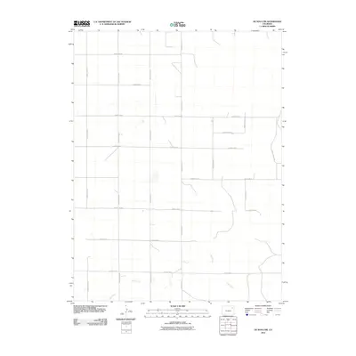
2010 Map of De Nova NW
USGS Topo · Published 2010About this map
Jack Creek meanders across the lower portion of this quadrangle, defining the primary drainage for this stretch of the Colorado High Plains. The landscape is structured by a rigid sectional grid of roads, primarily designated by double-letter names such as County Road QQ, County Road RR, and County Road VV. This geometric layout reflects the systematic land partitioning used for agricultural development in Washington County. In this environment, the intersection points of routes like County Rd 24 and County Road TT serve as the principal landmarks across an open, rural expanse. The sparse distribution of named natural features emphasizes the dominance of human-engineered boundaries and the essential role of water sources like the creek in an otherwise semi-arid agricultural region.
Find a feature on this map
17 named features on this map. Tap any name to fly to it.
Don’t see what you’re looking for? This feature index may not catch every label — zoom into the map to look around manually.
Map Details
Editions of this 2010 De Nova NW Map
This is the sole edition of this map. No revisions or reprints were ever made.
Other maps of this area

1954 · Limon
USGS Topo · 1:250,000

1954 · Sterling
USGS Topo · 1:250,000

1957 · Limon
USGS Topo · 1:250,000

1958 · Limon
USGS Topo · 1:250,000

1958 · Sterling
USGS Topo · 1:250,000

1972 · Snyder Lake
USGS Topo · 1:24,000

1972 · Otis SE
USGS Topo · 1:24,000

1973 · Akron SE
USGS Topo · 1:24,000

1974 · De Nova SE
USGS Topo · 1:24,000
1974 · De Nova NE
USGS Topo · 1:24,000