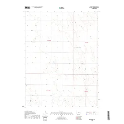
2019 Map of De Nova NW
USGS Topo · Published 2019About this map
Jack Cr winds through the southern reaches of this landscape in Washington County, defining the primary drainage pattern for an area largely organized by the Public Land Survey System. The map reveals the meticulous grid of Section, Township, and Range lines, including t1s r50w and t1s r49w, which dictate the placement of the local transportation network. A system of county routes, such as Co Rd 29 and Co Rd Tt, follows these administrative boundaries, reflecting the agricultural and ranching heritage of the Colorado plains. This 2019 survey documents a sparsely settled region where the interaction between natural seasonal waterways and human-imposed geometry remains the dominant geographic feature, providing a clear view of the rural infrastructure connecting disparate homesteads and fields via named corridors like Field Rd and Co Rd 22.
Find a feature on this map
22 named features on this map. Tap any name to fly to it.
Don’t see what you’re looking for? This feature index may not catch every label — zoom into the map to look around manually.
Map Details
Editions of this 2019 De Nova NW Map
This is the sole edition of this map. No revisions or reprints were ever made.
Other maps of this area

1954 · Limon
USGS Topo · 1:250,000

1954 · Sterling
USGS Topo · 1:250,000

1957 · Limon
USGS Topo · 1:250,000

1958 · Limon
USGS Topo · 1:250,000

1958 · Sterling
USGS Topo · 1:250,000

1972 · Snyder Lake
USGS Topo · 1:24,000

1972 · Otis SE
USGS Topo · 1:24,000

1973 · Akron SE
USGS Topo · 1:24,000

1974 · De Nova SE
USGS Topo · 1:24,000
1974 · De Nova NE
USGS Topo · 1:24,000