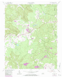
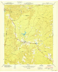
1954 Map of De Rossett
USGS Topo · Published 1984About this map
Ravenscroft and De Rossett anchor this mid-century survey of the rugged highlands where White and Putnam counties meet. The landscape is defined by the steep descent of Bee Creek and Geer Cove as they cut through the plateau, revealing a network of small settlements and industrial traces from a previous era. The presence of Bon Air and its accompanying Bon Air Cem hints at the coal mining history that shaped these communities, while the path of the former rail line, now marked by Broadway 1872, cuts directly through the heart of the terrain. Further south, the map details the rural character of Stringtown and Mobra, located near the slopes of Chestnut Mountain. Notable water features such as Buck Creek Lake and Spain Lake provide clear landmarks for local-history researchers and genealogists tracing family ties to these upland hamlets.
Find a feature on this map
34 named features on this map. Tap any name to fly to it.
Don’t see what you’re looking for? This feature index may not catch every label — zoom into the map to look around manually.
Map Details
Editions of this 1954 De Rossett Map
5 editions found

Other maps of this area

1892 · Pikeville
USGS Topo · 1:125,000

1895 · Pikeville
USGS Topo · 1:125,000

1897 · Standingstone
USGS Topo · 1:125,000

1898 · Standingstone
USGS Topo · 1:125,000

1912 · Crossville
USGS Topo · 1:62,500

1935 · Campbell Junction
USGS Topo · 1:24,000

1943 · Cookeville
USGS Topo · 1:100,000

1944 · Cookeville
USGS Topo · 1:100,000

1946 · Campbell Junction
USGS Topo · 1:24,000
1950 · Campbell Junction
USGS Topo · 1:24,000