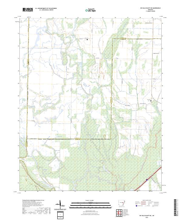
2024 Map of De Valls Bluff NE
USGS Topo · Published 2024About this map
The Cache River and its labyrinthine wetlands dominate this part of eastern Arkansas, where the borders of Woodruff, Monroe, and Prairie counties converge. This 2024 survey documents a landscape defined by seasonal water, featuring an extensive network of oxbows and sloughs such as Heifer Lake, Hickson Lake, and Mud Slough. Large portions of the terrain are protected within the Cache River National Wildlife Refuge, preserving a vital corridor of bottomland hardwood forest.
Find a feature on this map
49 named features on this map. Tap any name to fly to it.
Don’t see what you’re looking for? This feature index may not catch every label — zoom into the map to look around manually.
Map Details
Editions of this 2024 De Valls Bluff NE Map
This is the sole edition of this map. No revisions or reprints were ever made.
Other maps of this area

1935 · Gregory
USGS Topo · 1:62,500

1939 · Hunter
USGS Topo · 1:62,500

1940 · Brinkley
USGS Topo · 1:62,500

1941 · De Valls Bluff
USGS Topo · 1:62,500

1948 · Helena
USGS Topo · 1:250,000

1950 · Helena
USGS Topo · 1:250,000

1953 · Memphis
USGS Topo · 1:250,000

1955 · Helena
USGS Topo · 1:250,000

1956 · Memphis
USGS Topo · 1:250,000

1956 · Hunter
USGS Topo · 1:62,500